Blog
Find guidance and support for every step of your journey with our diverse range of articles. No matter your situation, we have insights to uplift and empower you!
SEDONA AREA HIKES AND
OUTDOOR ADVENTURE INFORMATION
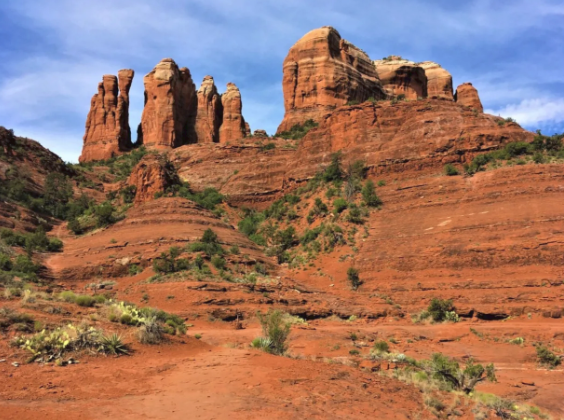
No Sedona trip is complete without a visit to perhaps it’s most famous rock formation — Cathedral Rock. I headed out soon after the rangers reopened it in the wake of the COVID-19 pandemic . I thought that it would be empty, but the parking lot was packed before 8 a.m. Granted it is nearly summertime in the desert, and things get toasty quickly. However, word to the wise: go early. Update, November 14, 2022: Visitors can now visit the trailhead more conveniently by taking the Sedona shuttle. You will need to do so if you arrive after the trailhead parking shuts down at sunrise. You can find information about the Sedona shuttle here . The trip up Cathedral Rock Trail isn’t entirely for the faint of heart. You can climb all the way to the spires, but doing so will require using hand-carved holds in the rock at one point and copious butt-sliding if you hope to descend safely. The rapid altitude change will increase your heart rate better than any stair-climbing routine. This hike is not for those with severe vertigo or other disabilities. Fortunately, while I have both, I’ve learned to work my way around them — at least most of the time. Today was one of my better days, which made me smile because I love a good rock scramble before breakfast. Don’t let the climb keep you away from this legendary landmark , however. You can enjoy breathtaking views from Templeton trail, which takes you around the rock. While it isn’t wheelchair-accessible unless you have a four-wheel drive on your device, it is a flat, pleasant stroll. It doesn’t get nearly as crowded as the ascent, so you can free yourself from the madding crowds and enjoy the beauty of nature. Along with the sides of the Cathedral formation, you’ll spy Courthouse Butte and the rabbit ears. Because I am a plant geek, I stopped to snap a few pics when a red hue more vivid than the rocks caught my eye. I was delighted to find a Parry’s agave towering nearly as tall as the surrounding trees. In case you were wondering, yes, you can use this plant to make tequila. That got me dreaming of a margarita and a siesta, so I headed back to my Jeep. My trek lasted only two miles, but you can follow Templeton trail for much longer. I elected to cut through Easy Breezy to return to the trailhead. Reader note: All photos on Only in Sedona are free to use! Please do us a favor and link back to us if you borrow any. Thanks!
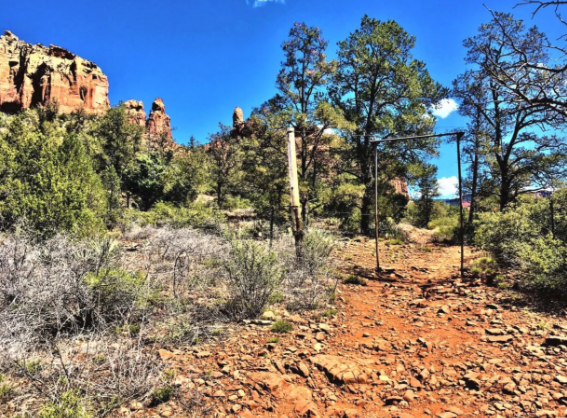
Are you seeking a mostly flat but gently rolling 5-mile hike with breathtaking views? The Jim Thompson trail will not disappoint you. You can cut the trek in half by parking a vehicle at either end, or you can do the full out-and-back journey. You won’t break too much of a sweat, but your jaw will drop more than once. The trail was named after the first European settler in 1887 , who needed a road between his property and what later became the town of Sedona. Today, horses still roam the pathway that their ancestors walked — I didn’t see any in the flesh, but the way was littered with apples of the dung variety. After the first half-mile, you come to a gate. Don’t worry — it doesn’t do an effective job of keeping people out. However, on part of your trek, you feel as if you’re walking directly up to the red rock walls. I found this extremely soothing, especially because our little town is on shelter-in-place restrictions due to the COVID-19 pandemic. You do cross a few small streams in wetter weather. Sedona’s winter has been wet and cold, so I crossed one or two. In the summer months, these will transform into arroyos — a fancy Spanish word for a bone-dry wash. From the trail, you can catch a glimpse of Chimney Rock and Summit. You can also see Cathedral Rock off in the distance. Most strikingly, you catch a glimpse of Snoopy sleeping peacefully on his red rock dog house. Aw! Before you know it, you wind your way behind the back of Ship Rock, one of the most recognizable formations in Uptown as you head toward Oak Creek Canyon. Later, as you approach the Midgely Bridge end of the trail, you get to see it from the other side. You don’t pass by many steep ledges, so no worries on this trail if you have a touch of vertigo. However, there are one or two spots where you can stop and have a picnic. That is, assuming that you can have contact with other folks in the outside world. Finally, as you near the trail’s end, you can catch sight of Midgely Bridge. If you take two vehicles, you can park one at the Jim Thompson’s trailhead, located off Jordan Road in Uptown. The other party can park at the Midgely parking area. I am loving life solo at the moment due to the quarantine, so I turned around and went back. Five miles in the sun felt glorious after being cooped up in the house all week. If you go: From Cottonwood, take Highway 89A north to Jordan Rd. in uptown. Follow the signs to the Jim Thompson trailhead parking area. The road in is a wee bit bumpy. You don’t need 4WD, but it helps. Alternatively, stay on Highway 89A north, cross Midgely Bridge, and park in the adjacent area. Both lots tend to get crowded when the nation isn’t in shutdown, so go early. Reader note: All photos on Only in Sedona are free to use! Please do us a favor and link back to us if you borrow any. Thanks!
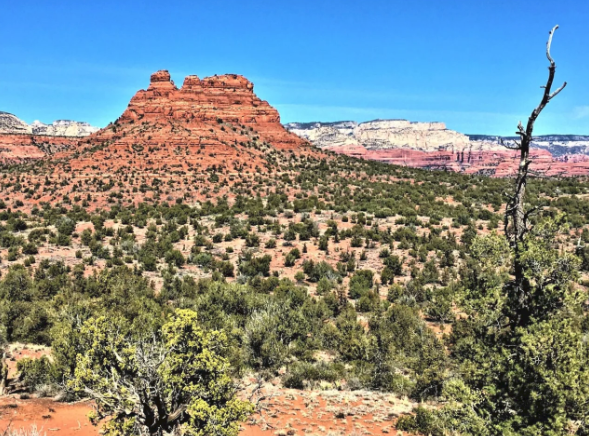
I hadn’t planned to add another 13.1-notch to my belt this weekend, but I’m glad that I did on this hike. Outer Limits is a newer 6.1-mile trail that you won’t find on many maps — including those on the trailhead. I couldn’t even locate it on Google Maps, though I’ll keep you posted if that changes. Update, November 14, 2022: You can now find this trail on many updated maps. The trail runs from the Cultural Park/Girdner Trailhead. It takes you all the way over to the Cockscomb rock formation , so named for what it resembles. The trail itself is 6.1 miles. Once you reach the intersection of Cockscomb, you have another nine-tenths of a mile to the Aerie Trailhead parking area. Although it was February 15, not 14, when I made my trek, Mother Nature nevertheless generously blessed me with the first spring flowers — and the heavenly sound of bees returning. The pretty pink flowers of this species of manzanita attract the little buzzers. It’s funny — bees used to frighten me a bit. Now that I know how crucial they are to the ecosystem, I smile every time I catch a buzz — of the auditory variety. The trail looks easy enough as you enter the woods. However, you do cross Dry Creek, which entails some significant hill climbing. Given the length, I’d rate this hike on the challenging side of moderate. It’s decidedly a favorite of the mountain bike crew — I was the only pedestrian I met. Everyone else had pedal power to cover the substantial mileage. Still, you will find plenty of places to stop and rest — and boost your intake of vitamin D , the sunshine nutrient. Pro-tip : Take plenty of water and snacks, particularly if you attempt this during the warmer months. I quickly lamented having only one thermos of herbal tea and a handful of nuts. By the time I finished my adventure, I was ready to eat the proverbial horse and dangerously thirsty. Yet another sign that spring arrives early in the desert — Dry Creek lived up to its name today, unlike on other adventures when it ran strong. Today? If it weren’t for the way Mother Nature carved the trench, you’d never know a river ran through it. Once you climb up and away from the riverbed, you can see across the small town to Courthouse Butte in the Village of Oak Creek. When I finally reached my destination, I had a decision to make. If you’re a tourist to our little neck of the woods, you’ll soon learn the wild west can welcome you harshly at times. While I wanted nothing more than to dial a ride from the parking area, cellphone reception out at the distant Cockscomb is iffy at best. Either way, I was looking at doubling the length of my journey. Did I want to travel home on pavement or dirt? If I could surround myself with trail dust like Pigpen from “Charlie Brown” fame, I would. However, if I ever find a 13.1 sticker, I’m displaying that puppy on my Jeep proudly. Getting there: From the south, Cottonwood direction, take Hwy 89A north to Cultural Park Road. Turn left and park in the dirt parking area at the Girdner trailhead. Outer Limits starts on the left side of the dirt road past the gate. Alternately, take Dry Creek Road to Boynton Canyon Road. Turn Left on Aerie Road and park at the Aerie trailhead. Reader note: All photos on Only in Sedona are free to use! Please do us a favor and link back to us if you borrow any. Thanks!
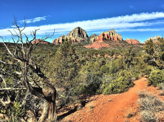
A stunning hike with unmatchable views. What started as a 1.5-mile hike ended up taking a hair over five today. I was happy as the proverbial mollusk at slightly getting lost in the woods. Plus, with views this jaw-dropping, who wouldn’t want to spend some time soaking in all the good stuff. The trail starts with magnificent glimpses of Thunder Mountain to the west and Ship Rock to the north. The first part of the path features rolling hills. You’ll elevate your heart rate slightly, but you won’t feel a hardcore burn. These trails see their fair share of biker traffic, so please remember to follow proper etiquette rules and give a friendly greeting to all you pass — it’s a small town, and we’re chummy like that. Today’s journey led from Adobe Jack Trail to Coyote. From there, we took Grand Central Trail to Manzanita. We took a detour on Javelina and completed our loop by exiting Crusty back onto Adobe Jack. The entire trek lasts approximately three to four miles, but I was unable to get an exact estimate. Followers of my other blog know I have a lively host of health conditions, and so does my hiking partner. He has to slow down, and I have to keep moving. As a result, I doubled back several times. I didn’t mind a bit! Along the way, you’ll enjoy views of some of Sedona’s most famous red rock formations. You’ll catch a glimpse of Marg’s Draw, where you can hike near the well-known Snoopy Rock. You’ll see Elephant Rock minus her impressive trunk. On parts of the trail, you can spy the spire of Chimney Rock , and on the way back, you’ll see Sugarloaf summit. If you decide to recreate this hike, make sure that you eat first. Crusty Trail takes you right past Mariposa Restaurant on the return trek, and you’ll smell the heavenly aromas from the grill. It doesn’t matter if you’re a vegetarian — the scent will make you drool. Chef Lisa Dahl isn’t a local legend for nothing. She makes me want to become a better blogger so that I can enjoy her culinary creations more often. Reader note: All photos on Only in Sedona are free to use! Please do us a favor and link back to us if you borrow any. Thanks!
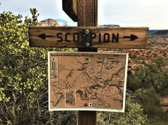
Are you seeking the ideal medium-length hike? Do you want a trek that will elevate your heart rate without making it pound out of your chest? Perhaps you merely dream of the opportunity of photographing one of Sedona’s most iconic rock formations without encountering too many fellow souls? If so, try the Scorpion-Pyramid Trail Loop. This loop comes in at a hair over 4.9 miles — almost a perfect quint. You’ll go up and down a bit, but you won’t encounter any places where bouldering becomes necessary. You will, however, lose your breath from the stunning views. You’ll encounter plenty of places to rest and enjoy a snack , so bring your favorite trail food with you. You shouldn’t need to refuel, but cashews taste better in the wilderness. During the colder months, why not pack a picnic lunch? Chances are, Yogi and Boo-Boo won’t appear to swipe your basket! You have two choices of where to park. If you park at Sedona Red Rock High School, you’ll get the full excursion. You can also park at the trailhead at the base of the Red Rock Loop Road. If you enter through this direction, you’ll cover a tad less than four miles total. The ascent is far less vigorous on the Pyramid side of the trail. If you want to blast your hamstrings and quads, go the opposite direction for a steeper climb. Don’t worry — the exertion still ranks as moderate. You’ll see the backside of Cathedral Rock , quite possibly the most photographed formation in all of Sedona. Many photographers shoot this vortex from the opposite angle. Dawn’s early sun typically blocks out decent photos from the east, but given the overcast weather, the rocks obliged by striking a pose. On the way back, enjoy views of the Rabbit Ears out in the distance. Whenever you’re in West Sedona, you can get your bearings by looking for Thunder Mountain. It’s nearly always ubiquitous in the northwest. Getting there: From Cottonwood, take AZ 89A North to Upper Red Rock Loop Road. Turn right and park at the high school OR follow the road to the parking area at the base of Red Rock Loop Road. Reader note: All photos on Only in Sedona are free to use! Please do us a favor and link back to us if you borrow any. Thanks!
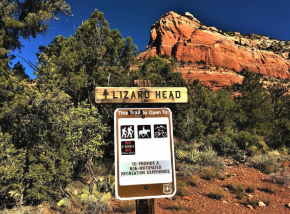
If you travel Dry Creek Road on a popular day, you’ll see cars lined up for what seems like a mile in each direction near Vultee Arch Road. If you want to beat what author Thomas Hardy referred to as the madding crowd, and you don’t mind walking an extra mile, Lizardhead Trail offers a way in minus the traffic. You’ll find the slightly hidden trailhead just past North Shores Drive. You’ll quickly come to a fork. If you go right, you’ll follow the Upper Lizardhead trail until it loops back. As of right now, the return fork lacks a sign, so I suggest going to the right. You’ll get your heart pumping a bit on the ascent. If you have vertigo, there are a few spots that might leave you shaky at the top. My advice? Keep walking and don’t look down. Of course, you can also take the lower Lizardhead trail proper. It’s relatively flat and simple to follow. You’ll pass the ubiquitous Thunder Mountain, which is visible from almost anywhere in Sedona. Here, you can see the top peaking over a hill and saying hello. The entire Lizardhead loop, upper and lower, is only 1.2 miles. I hadn’t planned on a long hike, but I always feel bummed when I’m off the trail so quickly. However, if your objective is to reach Chuck Wagon Trail, the Vista, and perhaps continue to Devil’s Bridge, you’ll enjoy plenty of adventure further along. The views from the vista don’t disappoint, though. Even if you turn around, you get to enjoy breathtaking scenery. I did the reverse of what I recommend. I entered via Lizardhead trail and returned by climbing over the top. However, I could have hopped on Girdner Trail and gone that way as well for a longer trek. Are you starting to see the way the trails connect? You get a great shot of the “lizard” as you ascend on the way back. Personally, I think the formation looks more like a turtle. When you reach the apex, you can barely catch a glimpse of Cathedral Rock hiding behind Summit and Chimney Buttes. Getting there: From Cottonwood, take Hwy 89A North to Dry Creek Road. Turn left on Dry Creek Road. You’ll find small places to park just east and west of North Shore Drive. Reader note: All photos on Only in Sedona are free to use! Please do us a favor and link back to us if you borrow any. Thanks!
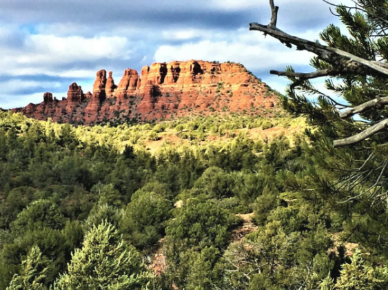
I love lazy Saturdays. Okay, so my weekends are rarely that restful — but would you kick it inside on the couch if you lived in one of the most beautiful places on earth? I hope not! Girdner trail is a medium-difficulty number in West Sedona. You’ll start at the same head where Stirrup and Saddle Up Trail make their way in (or out, depending upon your direction) to the wilderness. From the trailhead to the exit onto Dry Creek Road at the Two Fence trailhead, you’re looking at a 4.9-miler. You’ll cross over the creek, and if the waterway isn’t living up to its name , it can be tough to see where to go. On this day, the water level was low enough at the crossings to pose no difficulty. I was delighted. It was cold, and I wasn’t looking forward to wet socks. Instead, I found myself singing “Just Around the Riverbend” from Pocohantas. You’ll enjoy magnificent views as you gaze westward toward Boynton Canyon. You’ll see Cockscomb in the distance — another trail that sees relatively little tourist traffic. If you want to take off with your dog and not encounter another soul, I recommend both treks. I only met with one friendly fellow hiker on my adventure. Do you see the mesa in the distance in the above picture? That’s Doe Mountain, which is another breathtaking hike — literally. There’s one spot on the ascent that I’ve nicknamed “Vertigo Point.” Once you push past it, though, you can hang out and have a picnic at the top. But I digress. Back to Girdner. The trail was named for a family of ranchers who lived in the area. If you follow it to the end, you’ll emerge in the Seven Canyons wilderness. I hung a right turn at Two Fence because I arrived at the trailhead on foot. If you have a second driver, it’s worth it to hike 3/4 mile to the end so that you can shuttle yourself back. Of course, you could also turn around and go back the way you came. People get crafty in the desert. I stumbled upon this rock sculpture a nature artist built. It looked lovely framed by Chimney Rock and Thunder Mountain in the background. You’ll pass several other trails along the way, including the part where Stirrup and Saddle Up intersect. I’m dying to explore the AZ Cypress Trail myself. However, I hadn’t come equipped with food or water, only my two feet. The views on the exit didn’t disappoint. Getting there: From Cottonwood (south), take Hwy 89A north to the stoplight at Cultural Park Road. Turn left and park in the trailhead parking past the community college. Reader note: All photos on Only in Sedona are free to use! Please do us a favor and link back to us if you borrow any. Thanks!
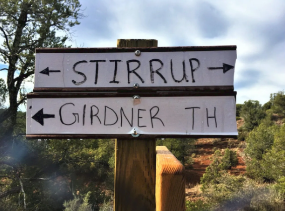
Saddle up, pardner! There’s a new trail in West Sedona. It’s relatively short — the direction I took only has you wandering in the woods for a mile. Still, when you see a path so shiny and fresh out of the box, it doesn’t have a completed sign yet, you take it! The trail goes up and down a little bit. It’s enough to elevate your heart rate, but not enough to make you break a sweat on a 50-degree day. Along the way, you enjoy stunning views of Thunder Mountain and Cockscomb in the distance. In wet weather, trickling creeks will play relaxing spa music to accompany your journey. I turned on Saddle Up. You’ll usually figure out the reason for the name of this trail quickly enough. From the apples, I’d say it sees regular equine traffic. If you retrace my steps, you’ll exit in a residential neighborhood. If you’re not from around these parts, it can prove tricky to find your way out. You could reverse your route, of course. I recommend staying straight on Stirrup, though, until it connects with Girdner further up. You’ll get a significantly longer hike, but you’ll exit the woods along the parking area on Dry Creek Road. Getting there: Take Highway 89A north from Cottonwood. Turn left at Cultural Park Drive to the Centennial/Girdner Trailhead parking. Take Girdner trail to Stirrup. Reader note: All photos on Only in Sedona are free to use! Please do us a favor and link back to us if you borrow any. Thanks!
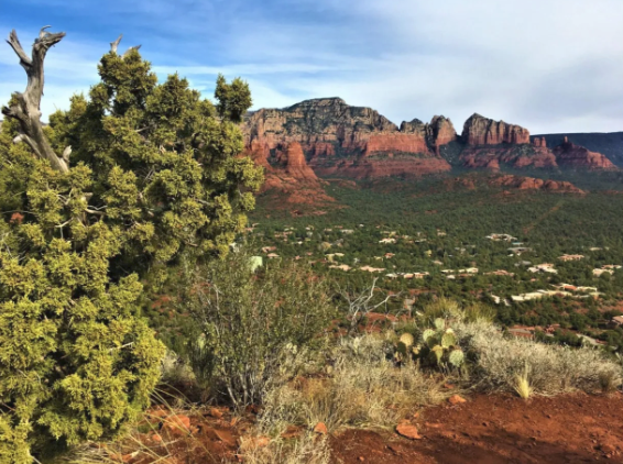
Are you looking for a flat roughly 2 1/2 mile hike that keeps you close to the heart of West Sedona? If so, you can trek from Sugarloaf to Chimney Rock or vice versa using a combination of the Teacup/Thunder Mountain/Adante trails. Views of Thunder Mountain greet you as you enter from the Sugarloaf parking area. You want to follow the path to the first signpost junction. Hang a right, and you’re headed toward your destination — but I suggest a side trip up Sugarloaf summit first. It only adds .3 miles to your trek, and it blasts your hamstrings — scaling a mountain is way more fun than hitting the Stairmaster! More importantly, you enjoy spectacular views. Once you’ve sunned yourself like one of the many Sedona geckos at the top, it’s time to pick your way back down and head to Chimney. The nice thing about this hike is, even if you get turned around in places, it’s hard to get lost. Merely head toward the rock with the flue-like spire at the top, and you’ll eventually reach it. The hike is as flat as you can find around these parts. If you’re a trail runner or biker, it won’t give you any challenges. You’ll pass a few interesting formations along the way. Sometimes, you pause to photograph a random rock and prickly pear — why not? These cacti are gorgeous any time of year, but especially in the spring, when they come alive with blooms. As you near the end of your trek, you’ll see Summit Rock approaching. Like Sugarloaf, this mountain is a short heart-pounder that will *switches to infomercial voice* give you that toned, sexy derriere you desire. However, my dinner was calling me, and since I had arrived on foot, I still had to run home. I opted to scale Summit another day. I took one look back at Sugarloaf from where we came and exited the parking area, stage right. Getting there: Take Highway 89A north from Cottonwood. Turn left on Coffee Pot drive. Turn left at the stop sign at Sanborn Drive. Turn right at the stop sign at Little Elf. Follow the brown hiking signs to the Sugarloaf/Teacup trail parking area. Reader note: All photos on Only in Sedona are free to use! Please do us a favor and link back to us if you borrow any. Thanks!

