Outer Limits to Cockscomb
I hadn’t planned to add another 13.1-notch to my belt this weekend, but I’m glad that I did on this hike. Outer Limits is a newer 6.1-mile trail that you won’t find on many maps — including those on the trailhead. I couldn’t even locate it on Google Maps, though I’ll keep you posted if that changes.
Update, November 14, 2022: You can now find this trail on many updated maps.
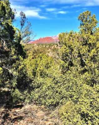
The trail runs from the Cultural Park/Girdner Trailhead. It takes you all the way over to the Cockscomb rock formation, so named for what it resembles. The trail itself is 6.1 miles. Once you reach the intersection of Cockscomb, you have another nine-tenths of a mile to the Aerie Trailhead parking area.
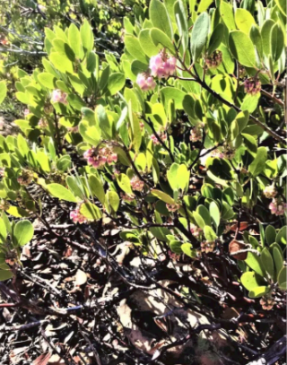
Although it was February 15, not 14, when I made my trek, Mother Nature nevertheless generously blessed me with the first spring flowers — and the heavenly sound of bees returning. The pretty pink flowers of this species of manzanita attract the little buzzers. It’s funny — bees used to frighten me a bit. Now that I know how crucial they are to the ecosystem, I smile every time I catch a buzz — of the auditory variety.
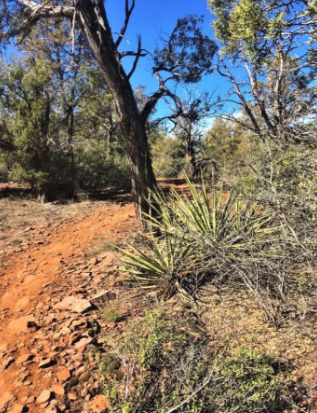
The trail looks easy enough as you enter the woods. However, you do cross Dry Creek, which entails some significant hill climbing. Given the length, I’d rate this hike on the challenging side of moderate. It’s decidedly a favorite of the mountain bike crew — I was the only pedestrian I met. Everyone else had pedal power to cover the substantial mileage.
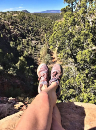
Still, you will find plenty of places to stop and rest — and boost your intake of vitamin D, the sunshine nutrient.
Pro-tip: Take plenty of water and snacks, particularly if you attempt this during the warmer months. I quickly lamented having only one thermos of herbal tea and a handful of nuts. By the time I finished my adventure, I was ready to eat the proverbial horse and dangerously thirsty.
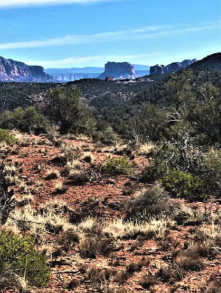
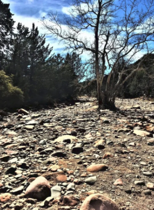
Yet another sign that spring arrives early in the desert — Dry Creek lived up to its name today, unlike on other adventures when it ran strong. Today? If it weren’t for the way Mother Nature carved the trench, you’d never know a river ran through it. Once you climb up and away from the riverbed, you can see across the small town to Courthouse Butte in the Village of Oak Creek.
When I finally reached my destination, I had a decision to make. If you’re a tourist to our little neck of the woods, you’ll soon learn the wild west can welcome you harshly at times. While I wanted nothing more than to dial a ride from the parking area, cellphone reception out at the distant Cockscomb is iffy at best. Either way, I was looking at doubling the length of my journey. Did I want to travel home on pavement or dirt? If I could surround myself with trail dust like Pigpen from “Charlie Brown” fame, I would. However, if I ever find a 13.1 sticker, I’m displaying that puppy on my Jeep proudly.
Getting there: From the south, Cottonwood direction, take Hwy 89A north to Cultural Park Road. Turn left and park in the dirt parking area at the Girdner trailhead. Outer Limits starts on the left side of the dirt road past the gate. Alternately, take Dry Creek Road to Boynton Canyon Road. Turn Left on Aerie Road and park at the Aerie trailhead.
Reader note: All photos on Only in Sedona are free to use! Please do us a favor and link back to us if you borrow any. Thanks!